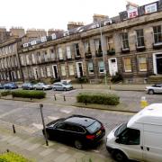
Scottish Water is about to start work on East Claremont Street.
After over 100 years' service, a stone sewage pipe connecting property on the north side of the street to the main sewer in the middle is now in a ‘state of disrepair’. It needs replaced, which process will last 2 weeks starting in early February.
Work will affect the outside lane next to Nos 65–69, with inside-lane parking bays suspended to let traffic pass.
Excrementitious meanderings through history
Finding information about Edinburgh’s sewerage system is a lot harder than you might think. Online sources are not accessible to the public, partly because the GIS system is too large to download in a lump, and partly because – according to Scottish Water – the authorities prefer to keep such details in places where those with ‘nefarious intentions in mind’ can’t find them. Instead, curious locals must content themselves with historical nuggets.
The most widely cited academic source is P.J. Smith’s 1975 article 'The Foul Burns of Edinburgh: Public Health Attitudes and Environmental Change' in Scottish Geographical Magazine, Vol. 91. You’ll need institutional access to read it online, but an interesting alternative with some local detail and advice on where to find a Victorian map overlay appears in Rob St. John’s ‘Liquid City: Finding Lost Lines of Water’.
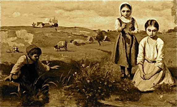
Edinburgh’s sewage system was not completed until after the First World War, and for many years relied solely on streams and the force of gravity. The Broughton Burn – which began in Queen Street Gardens and gurgled in convolutions via London Street, Bellevue and on down to Bonnington – was used for this purpose.
The Broughton Burn

In a report of January 1872, Leith Street-born Dr Henry D. Littlejohn, Edinburgh's Medical Officer of Health, observed that the Burn was now an open ditch:
... first visible in front of Mansfield Place [and receiving] the surface and house drainage of a built-on area seventy acres in extent ... . Within the limits of Edinburgh ... it is situated at such distance from houses that no complaint has ever been made to me as a Public Officer on account of any offensive odours. The burn consists of ... surface water and the overflow of the various cess-pools of the district which drains into it ... . All the houses in this locality, with few exceptions, have been in existence for many years, and are provided with built cess-pools, which receive the solid refuse, and permit of the escape of only the surface fluid, and at all times there is in addition a quantity of soapy fluid discharged from the houses, which gives a turbid appearance to the burn at this portion of its course. No excrementitious matters are visible, these being retained in the cess-pools.
Behind Blandfield House, the burn, which has increased in volume by the sewage from the Gayfield Square district ... is diverted to irrigate about six acres of meadow land, and after being thus thoroughly filtered, it is again restored to its channel ... at Pilrig Street. ... Its channel is narrowed by planking, so as to give the stream a rapid flow. Here a marked change is observed in the character of the burn. Its course of 1100 yards has freely exposed it to the atmosphere, and it has been gradually purified by oxidation, while the filtering process of irrigation has removed from it its disagreeable qualities. As it flows swiftly along, with its banks protected by boards, it presents the appearance of an ordinary burn, with nothing to offend the senses of smell or sight, and in this condition it leaves Edinburgh and enters Leith.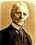
Slow motions
And so on to the section between Stead's Place and the outfall into the Water of Leith at today's Anderson Place. Here – according to Littlejohn – things went rapidly downhill, but not rapidly enough. The Burn became:
... a nuisance of no ordinary magnitude. ... Its course is irregular, no efforts are made to confine it within due limits, and as the field in question is the favourite play ground of boys, the channel of the stream, naturally enough sluggish at this point, is covered by numerous obstructions in the shape of stones, baskets, dead animals, and refuse of all kinds. ... Its condition here is is such as to excite disgust, and during the summer, complaints were made by the inhabitants of cottages in the immediate vicinity.
Long since canalised, sunk and hidden from view, the Broughton Burn still hastens locals' blameless but unwelcome little travellers on their way to Seafield, and is routinely inspected from beneath a pebble-dashed structure at the bottom of Broughton Primary School’s playground.
Municipal evacuation and further reading
In the 19th century, such more or less stinky meanderings were part of a process known as 'sewage farming' – justified by City Fathers across Britain as a cost-effective means of draining municipalities to fertilise nearby fields. Bill Luckin, in The Cambridge Urban History of Britain, comments that the economic benefits of this practice were always exaggerated, and certainly did not outweigh the downsides of Edinburgh’s ‘filth-impregnated meadows’.
Jamie Benidickson, in his chapter ‘Muncipal Evacuation’, quantifies this flow for the city as a whole. It began in the 18th century around Craigentinny, and some 100 years later was ‘dispersing about 800 cubic feet per minute in season across plots of land covering 236 acres’. (This chapter appears in Benidickson’s spendidly titled and highly readable The Culture of Flushing: A Social and Legal History of Sewage, published – with a horrible front-cover photograph – by the University of British Columbia in 2007. It is a great stocking filler for the right kind of person.)
Information from Scottish Water about householders' waste pipes can be found here.
[Bottom photo: Wikipedia, free commons.]
[For the Littlejohn report and our understanding of the Broughton Burn, we are greatly indebted to John Dickie.]
---------------------------


East Claremont St roadworks, municipal evacuations, excrementitious meanderings: http://www.broughtonspurtle.org.uk/news/east-claremont-st-roadworks-end-jams … pic.twitter.com/pJJhXur1RP

@theSpurtle great to see something about the Broughton Burn: you know it's the reason Leith Community Treatment Centre is the shape it is...
@talkporty Didn't know that. What do you mean?
@theSpurtle psychogeography; burn left mark on property & municipal boundaries etc; check http://maps.nls.uk/geo/explore/#zoom=19&lat=55.97119&lon=-3.17641&layers=B000000000FFFFFFFFFFFFFFFFFFFFFFFFFFFFFFFFFFFFFFFFFFFFFFFFFFFFFFFFFFFFFFFFFFFFFFFTFFFFFFFFFFFFFFFFFFFFFFFFFFFFFFFFFFFFFFFFFFFFFFFFFFFFFFFFFFFFFFFFFFFFFFFFFFFFFFFFFFFFFFFFFFFFFFFFFFFFFFFFFFFFFFFFFFFFFFFFFFFFFFFFFFFFFFFFFFF … pic.twitter.com/twMhV9TDX7
@talkporty Excellent. Thank you.
Sir
Allow me to congratulate you on the long overdue exposition of the historic role of the Broughton Burn in the context of the East Claremont Street roadworks, and, indeed, the wider economic, political, social and legal impact of drainage and sewage.
To further discourse on this matter, I would like to draw your attention to an excellent and fluently written article in the American Scientist which reviews three outstanding books – including one mentioned in your piece – which together treat the issue in the most comprehensive fashion.
Of more local, but perhaps deeper, interest is another reference I would like to share with your readers: the archive of Edinburgh's drainage records (1875–1950), which can be found here.
Alas, navigating through its 110,000 records is not a smooth affair and does take some effort.
Yours faithfully
Harald Tobermann
(Pilrig Street)