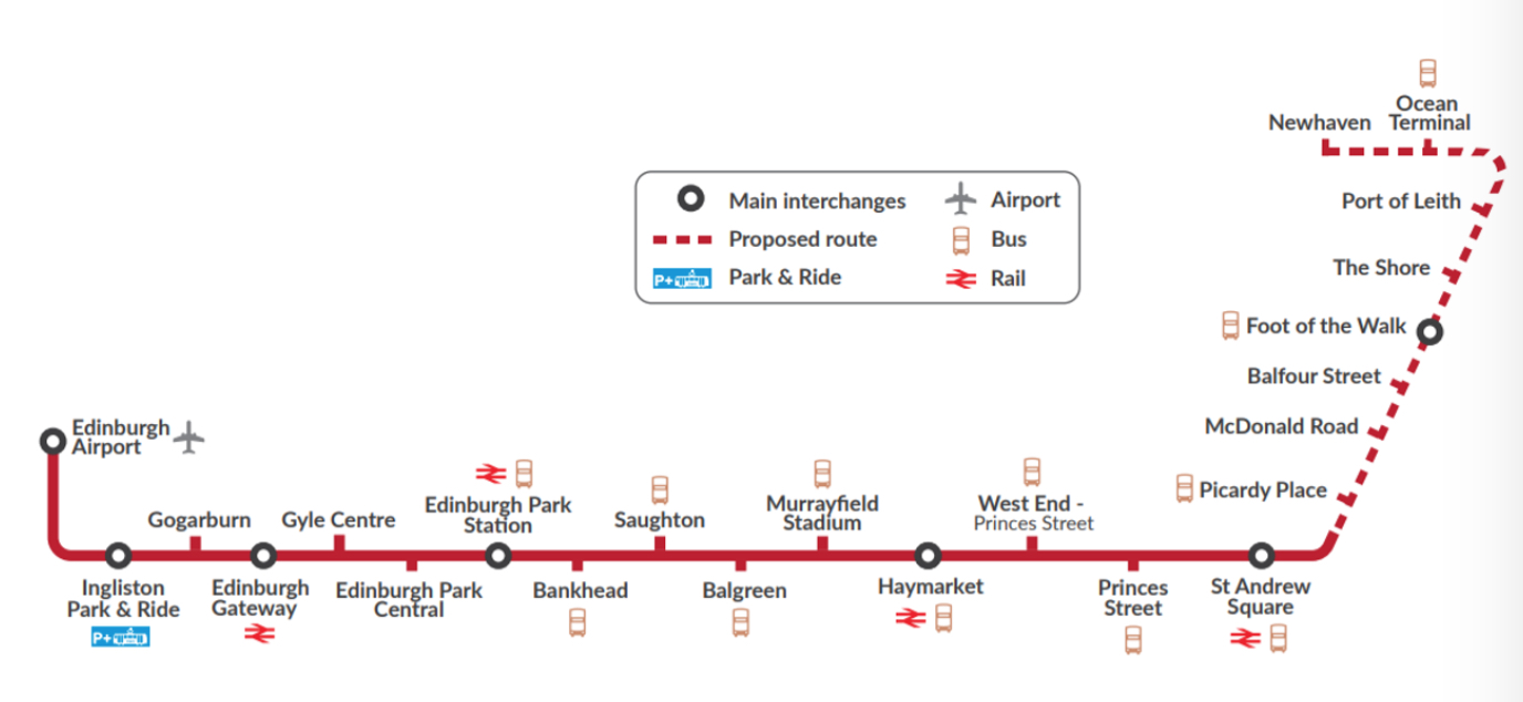
City of Edinburgh Council has consulted the public today about the proposed layout of the (as yet unapproved) tramline from Broughton to Newhaven.
The event, held in McDonald Road Library (10am–4pm), was well attended for the hour we attended, with enough staff on hand to answer questions.
It involved a few explanatory display panels, and a table-mounted linear plan, which this viewer did not find particularly easy to read. Better are the zoomable online versions available HERE.
Spurtle will concentrate on that section of the route in Broughton – from York Place to Pilrig Street.
Bad start
Unfortunately, the plans on show do not start well as the section covering Picardy Place has been superseded by the gyratory. The tram stop will be delivered separately in 2019/2020 by the developer behind the Edinburgh St James shopping mall.
So inaccurate details on show today can be ignored, as (we hope) can the absence of a pedestrian crossing close to the Playhouse.
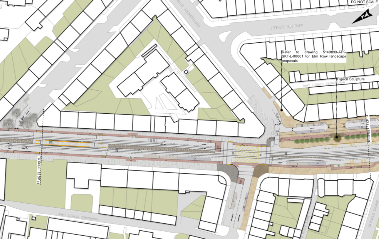
London Road and Elm Row
The plans become interesting at London Road, where new crossings for pedestrians and cyclists appear at the very end. (Gone is today’s, two-stage crossing).
The much-missed clock and pigeon sculptures are marked for a return to the end of Elm Row, in a section which cyclists and pedestrians will have to share prior to crossing the road. There are similar arrangements at the ends of Montgomery, Albert and Annandale Streets, and kinks behind bus stops on both sides of Croall Place and opposite the end of Pilrig Street. Such mixing assumes equal levels of awareness, eyesight, physical coordination, responsibility and mutual consideration. We don’t think it works well at Croall Place or North St Andrew/Queen Street, and we doubt it will fare better elsewhere.
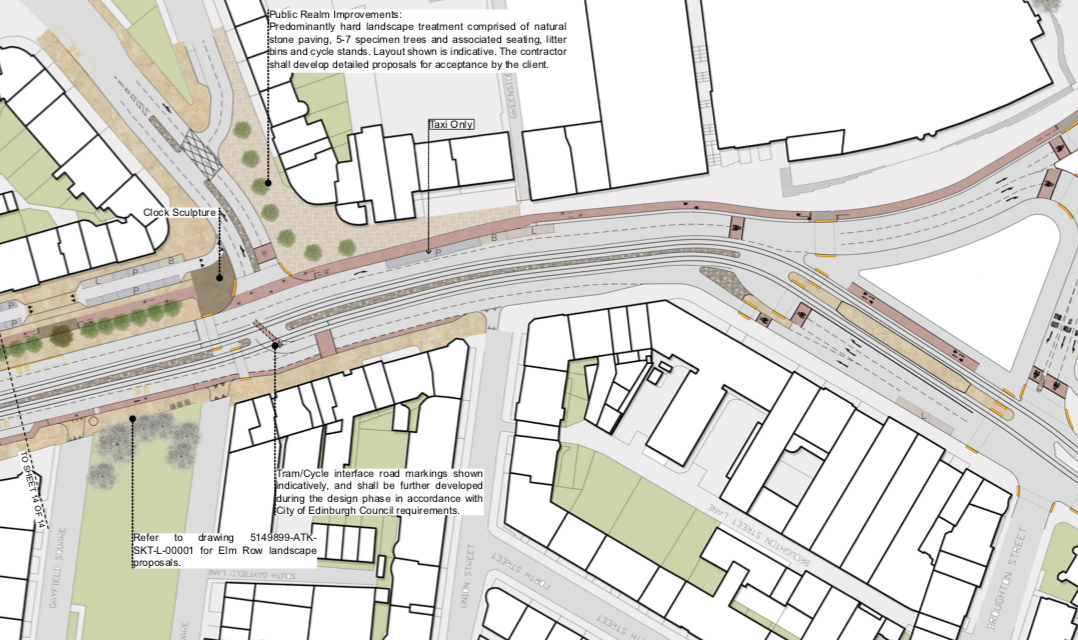
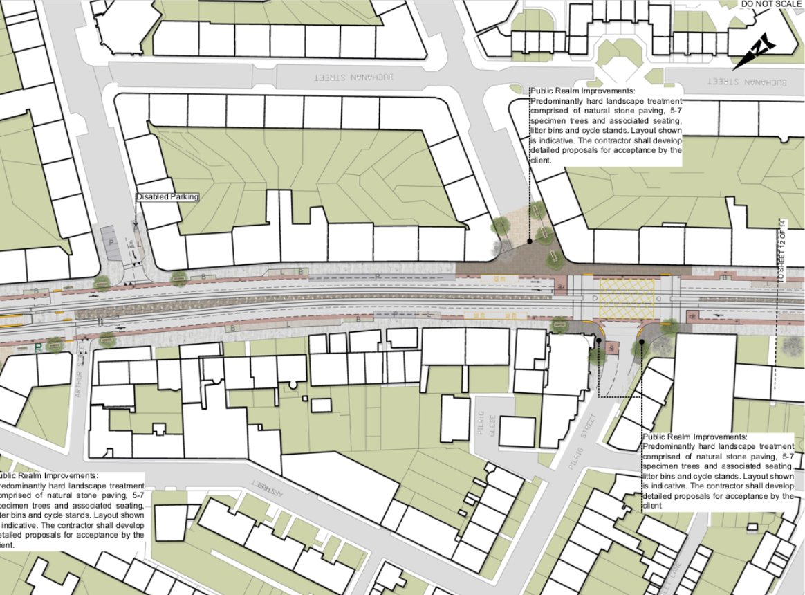
An ‘improved’ public realm is envisaged for the old Dofo’s/RBS corner, with 5–7 ‘specimen trees’ (for dogs about to visit the vet?), seating, litter bins and cycle stands. Details and layout have still to be finalised. Similar vagueness surrounds improvements at the ends of Pilrig and Iona Streets, but improved areas for people to congregate and socialise would, in theory, be welcome.
The pavements here are coloured brown on the plan, indicating ‘natural stone paving’. This is used on both sides of the road down to Annandale Street, the boundary of the World Heritage Site and seemingly the outer edge of Edinburgh’s desire for excellence.
The planned pavement is slightly narrower than before alongside Gayfield Square, but wider on the opposite side of the road where many additional trees are envisaged.
An interesting diagonal road marking indicates the proposed route for cyclists turning right and across the tram tracks into London Road. This ‘interface’ has yet to be fully developed.
Overcrowding at McDonald Road?
To our untutored eye, the area around the McDonald Road tram stop looks cramped. This is expected to be one of the two busiest stops on the line, and in particular the prospect of trams disgorging fans in sudden bursts on match days makes us wonder about overcrowding. We see every chance of sudden surges of people crossing the road regardless of lights.
Too few crossings
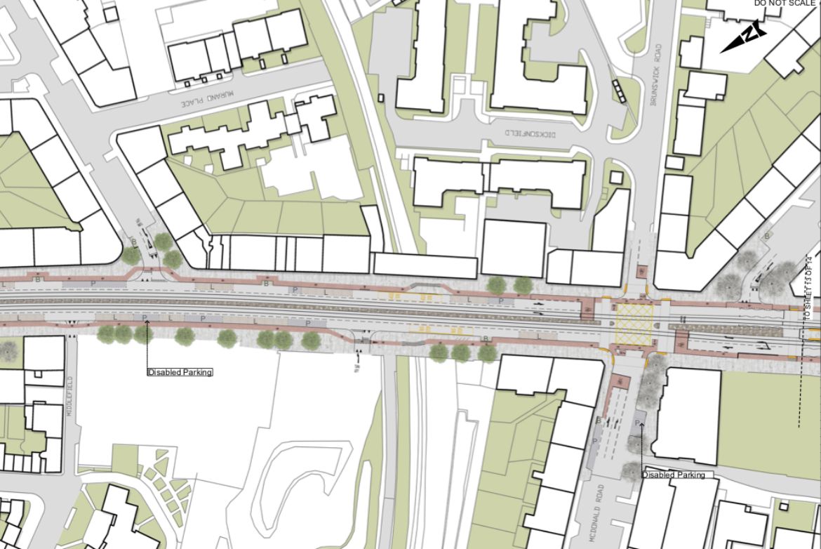
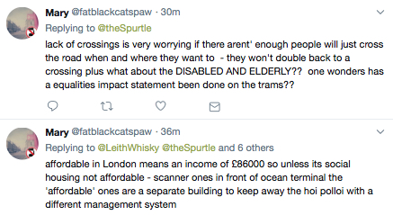
Between McDonald Road and Pilrig Street (and between Balfour Street and the Foot of the Walk), there are no signalised pedestrian crossings. This strikes Spurtle as a major oversight which needs attention.
‘Informal’ crossings over raised central sections may be added to address this lack for confident, sighted and nimble people, but are not appropriate for many others.
Similarly, we did not notice formal crossings at the Albert St and Middlefield junctions.
Problems for cyclists
As far as we could understand it, cyclists will not be able to turn right directly into Brunswick Street (or right, out of Brunswick Street) owing to a combination of the McDonald Road tram stop and a raised planter. They will instead have to use one of the pedestrian crossings at the end of the tram platform.
The current two-stage right turn for cyclists will be retained at Pilrig Street (and repeated at the junction of Queen Charlotte and Constitution Streets). However, the bike lanes are interrupted by bus stops on both sides of Leith Walk just north of Pilrig Street.
There is a more generalised problem with the bike lanes throughout the scheme. As far as we can tell, there is no hard barrier segregating them from other traffic. We all know that motorists routinely swerve into and park on bike lanes – a problem which is easily (but expensively) fixed. Perhaps ‘splitter kerblines’, as reported in Issue 270 (p.3), will resolve some or all of this problem in due course.
In the section of the proposed route between Picardy Place (not including the gyratory) and Pilrig Street, we noticed the addition of around 50 new trees. There is no detail about what kind of trees these may be, but in principle we welcome their arrival.
In general, we would like to see many more benches along the entire length of Leith Walk where people could rest and look at their mobile phones without bumping into people.
We would also welcome the introduction of new bus shelters. The current JCDecaux designs offer inadequate protection from the elements, block travellers’ view of the buses, and visually clutter the streetscape with distracting advertisements.
Over to you
Spurtle is no expert on how to beautify or improve city streets. We may very well have missed or misunderstood something important here. If so, kindly let us know.
In addition to the online consultation linked above, there are two further public consultations scheduled. See our EVENTS page.
Got a view? Tell us at spurtle@hotmail.co.uk and @theSpurtle and Facebook
[Image top-right: Wikimedia, Creative Commons]
------------
For anyone unable to read the jpeg comments below, here is an alternative way to access a substantial part of the thread.